CB,
My local station just reported Baytown had 24". Not sure of that but he also said Beaumont above 12"
My local station just reported Baytown had 24". Not sure of that but he also said Beaumont above 12"
Yep. Just watched weather. Still have chances for rain but mostly likely only in the 1/2 to 3/4 inch range. At least the cloudy skies and cooler weather are a break from the heat. Coastal areas are drowning in a years worth of rain in only a few days. Prayers for allCaustic Burno said:TexasBred said:Keeping my fingers crossed. I haven't had any measurable rain since early July. Gonna put out hay next week IF we don't get any rain out of this .
I hope for y'all.
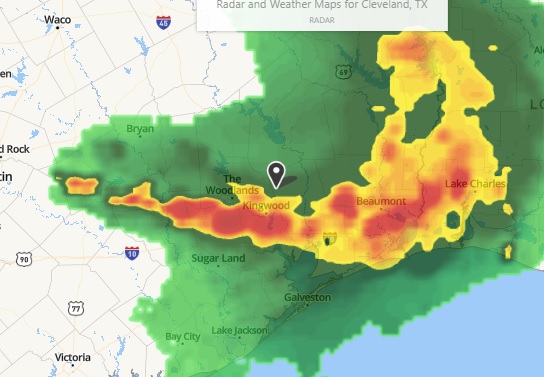
Watching radar today looks like it has moved farther east than earlier predictions.
TexasBred said:Yep. Just watched weather. Still have chances for rain but mostly likely only in the 1/2 to 3/4 inch range. At least the cloudy skies and cooler weather are a break from the heat. Coastal areas are drowning in a years worth of rain in only a few days. Prayers for allCaustic Burno said:TexasBred said:Keeping my fingers crossed. I haven't had any measurable rain since early July. Gonna put out hay next week IF we don't get any rain out of this .
I hope for y'all.
Watching radar today looks like it has moved farther east than earlier predictions.
sassafras manor said:We are so wet in central Illinois that I am feeding hay in sacrifice areas to keep the cows from muddying up the pastures. Our lawn grass is growing faster than I can mow it between showers. My son has only played 2 of his 7 scheduled baseball games because of rain outs.
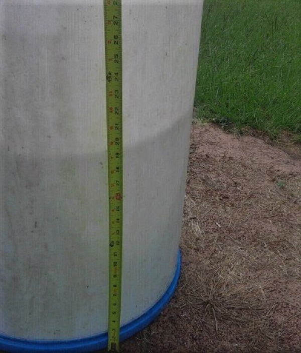
greybeard said:How much total rain we had since just after midnight Thursday morning thru this afternoon.
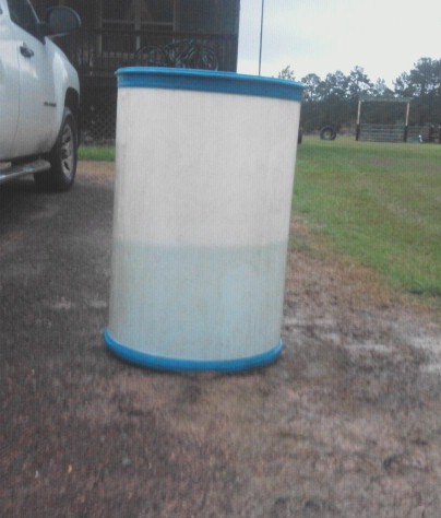
Looked like this Thursday around 10am: