Day trip

Help Support CattleToday:

Ky hills

Well-known member
Joined
Feb 4, 2016
Messages
6,608
Reaction score
7,465
Location
Clark County, KY
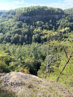
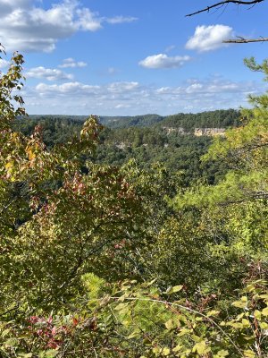
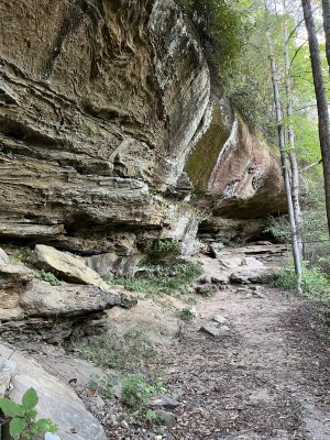
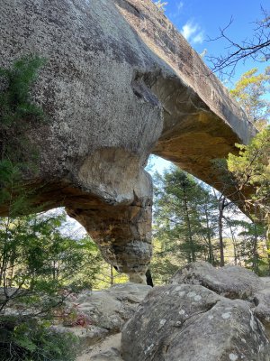
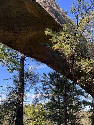
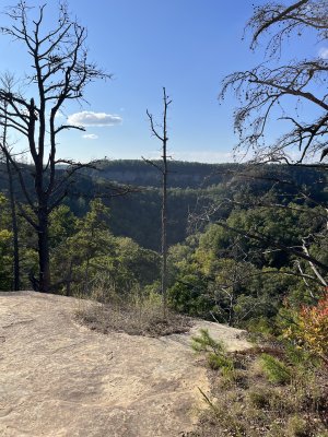
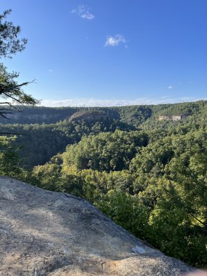
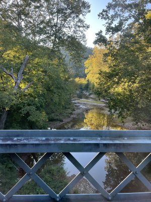
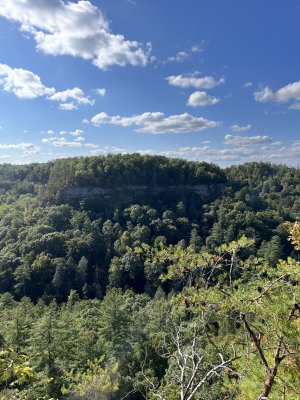
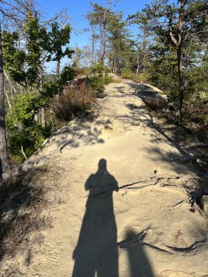
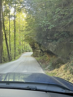
We took the afternoon off and went about 35 miles or so east to the Red River Gorge, area of the Daniel Boone National Forest. We were going to a place called Chimney Rock which we haven't been to, but on the trail we met sone folks that said the suspension bridge was damaged so we turned back and went to another destination in the area called Sky Bridge and walked a 3/4 mile round trip under and across that natural sandstone bridge formation.
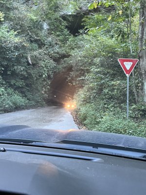
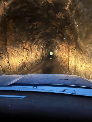
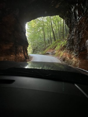
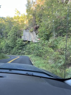
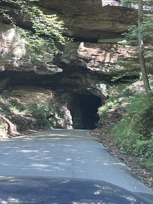
There's a neat one lane tunnel through the mountain on the way, that was dug out by dynamite and hand it was opened up as a way to get logs out of the area when it it was a booming logging community, years ago.
We finished out the trip by eating at the restaurant at the lodge at Natural Bridge State Park, which is also home to a large natural sandstone bridge.
E853D5BB-C2E8-42E4-B7F8-B62EB16F157B.jpeg014273CD-CD3C-4633-8135-713FD367280A.jpeg64C343C6-9730-4392-B0A2-EBE6F8853F9A.jpegBAA144C9-4E6B-44AF-B1C1-4EB64CCAE9C8.jpeg1A8C0FA9-E1D5-4158-9AE6-2FA2A212FAE0.jpeg61E8D189-48B1-4FAF-B3E4-54195D6B6C00.jpegDD9BE75F-18A4-492C-B187-F5D2A9240230.jpeg7C4B978C-8B20-4799-8129-533BD65A517D.jpeg909D1416-FB5F-40FF-865D-9EEA5FDC2027.jpegDEE73A64-9140-4A94-AA91-B6F6667490EF.jpeg1F22F273-76E3-4C4E-963F-BEEF074C8438.jpegA233FB06-5F70-49D1-86BA-D5BD9138D4CF.jpegCA345343-17E7-4547-9BD9-0901544302D2.jpeg
 
We took the afternoon off and went about 35 miles or so east to the Red River Gorge, area of the Daniel Boone National Forest. We were going to a place called Chimney Rock which we haven't been to, but on the trail we met sone folks that said the suspension bridge was damaged so we turned back and went to another destination in the area called Sky Bridge and walked a 3/4 mile round trip under and across that natural sandstone bridge formation.
There's a neat one lane tunnel through the mountain on the way, that was dug out by dynamite and hand it was opened up as a way to get logs out of the area when it it was a booming logging community, years ago.
We finished out the trip by eating at the restaurant at the lodge at Natural Bridge State Park, which is also home to a large natural sandstone bridge.
View attachment 35439View attachment 35440View attachment 35441View attachment 35442View attachment 35443View attachment 35444View attachment 35445View attachment 35446View attachment 35447View attachment 35448View attachment 35449View attachment 35450View attachment 35451
I miss the south east for the trees and landscape. Not so much the bugs...
 
Well KY I think you have now beat Lithuanian Farmer for the most photos in a post. I enjoyed those that I got to see the others are still loading.
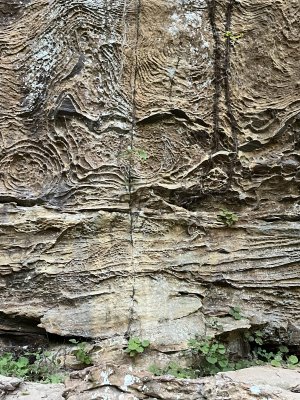
Those circular cobweb like patterns on the rock face, do you know anything about those, how they were formed.

Ken
 
Well KY I think you have now beat Lithuanian Farmer for the most photos in a post. I enjoyed those that I got to see the others are still loading.
Those circular cobweb like patterns on the rock face, do you know anything about those, how they were formed.

Ken
 
Well KY I think you have now beat Lithuanian Farmer for the most photos in a post. I enjoyed those that I got to see the others are still loading.
Those circular cobweb like patterns on the rock face, do you know anything about those, how they were formed.

Ken
No, I don't know how they were formed.
Yeah, I told my wife I was going to make a post and put a lot of pictures.
At another site there is some real old writings or symbols in the rock, but it it's closed off to the public. Some have seen it, presumably on guided tours.
The sad thing is, people carve their names or initials into the rock. The top of the bridge is covered in that kind of thing, such as shame.
 
The sandstone bridge is insane 😲
The one at Natural Bridge State Park nearby there is much larger, but a longer and bit more challenging hike, but not too bad. It also has a sky lift going up to it.
There are several of those sandstone bridges in the area, some in the parks and some on private property.
The area is very slowly getting more commercialized. They have been talking for years about making it into a Gatlinburg type area,
Whether that will ever happen or not I don't know.
 
Great pictures except for all those large brown and green things that obscure some of the view.

About those names people write or carve into the top of the bridge...
In some yet unknown timeline, those names may be seen in the same way ancient pictographs are in some of the caves out here in the southwest. Evidence of life of a long bygone type civilization.
 
Great pictures except for all those large brown and green things that obscure some of the view.

About those names people write or carve into the top of the bridge...
Think large...
In some yet unknown timeline, those names may very well be seen in the same way ancient pictographs are in some of the caves out here in the southwest. Evidence of life of a long bygone type civilization.
That's one way of looking at it.
The ancient symbols carved into the cavern there in park may be similar to the ones in the west.
Not far from where my wife is from there is a place called the Heaverner Rhunestones where there is some ancient symbols carved.
Who knows maybe if things hold out people can be marveling at symbols like TJ loves MC or any other combination or initials plus a year, I saw one yesterday either it was somebody's birthday in 1950 or that was the day they were there.
 
Great pictures except for all those large brown and green things that obscure some of the view.

About those names people write or carve into the top of the bridge...
Think large...
In some yet unknown timeline, those names may very well be seen in the same way ancient pictographs are in some of the caves out here in the southwest. Evidence of life of a long bygone type civilization.
Yeah, scratching their head wondering WTH OMG LOL ROFLMAO all meant to us ground dwelling misfits.
 
Some of the grandkids were up there just the other day and the pictures they brought back could easily be interchanged with yours.
I've been there many times over the last half century. Seems like I like the chair lift to the top a lot better than I use to.
 
Some of the grandkids were up there just the other day and the pictures they brought back could easily be interchanged with yours.
I've been there many times over the last half century. Seems like I like the chair lift to the top a lot better than I use to.
I'm not too fond of that chairlift myself, that last part of the ride going up to the top looks like a looong way down if something was to go wrong. I reckon I'm not as adventurous as some people are.
They have zip lines somewhere up there too, but I ain't going to tackle that for sure.
 
Beautiful country. Looks a lot like the Ozarks and Ouachita's here in Arkansas. Speaking of the Runestone near Heavener, I'm only 25 miles away and had never visited until we took the grandkids a couple weeks ago. I need to get out more.
 

Latest posts

Top